BRIAN
the BRain for an Integrated Arctic Network
report
co-author
2013


Abstract:
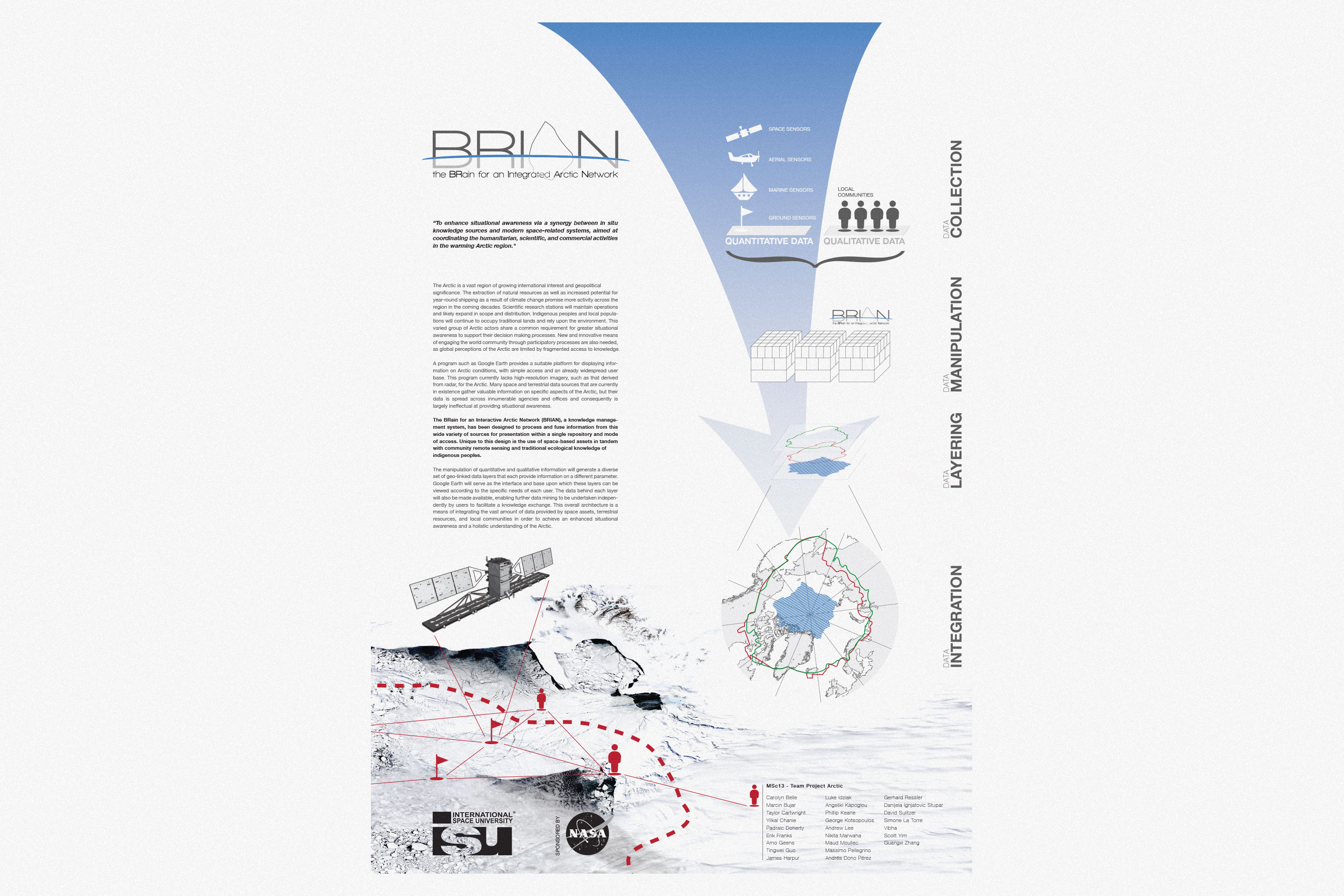
The Arctic is a vast region of growing international interest and geopolitical significance. The extraction of natural resources as well as increased potential for year-round shipping as a result of climate change promise more activity across the region in the coming decades. Scientific research stations will maintain operations and likely expand in scope and distribution. Indigenous peoples and local populations will continue to occupy traditional lands and rely upon the environment. This varied group of Arctic actors share a common requirement for greater situational awareness to support their decision making processes. New and innovative means of engaging the world community through participatory processes are also needed, as global perceptions of the Arctic are limited by fragmented access to knowledge. Many space and terrestrial data sources that are currently in existence gather valuable information on specific aspects of the Arctic, but their data is spread across innumerable agencies and offices and consequently is largely ineffectual at providing situational awareness. The BRain for an Integrated Arctic Network (BRIAN), a knowledge management system, has been designed to process and fuse information from this wide variety of sources for presentation within a single repository and mode of access. Unique to this design is the use of space-based assets in tandem with community remote sensing and traditional ecological knowledge of indigenous peoples. The manipulation of quantitative and qualitative information will generate a diverse set of geo-linked data layers that each provide information on a different parameter. Google Earth will serve as the interface and base upon which these layers can be viewed according to the specific needs of each user. This overall architecture is a means of integrating the vast amount of data provided by space assets, terrestrial resources, and local communities in order to achieve an enhanced situational awareness and a holistic understanding of the Arctic.
The Arctic is a vast region of growing international interest and geopolitical significance. The extraction of natural resources as well as increased potential for year-round shipping as a result of climate change promise more activity across the region in the coming decades. Scientific research stations will maintain operations and likely expand in scope and distribution. Indigenous peoples and local populations will continue to occupy traditional lands and rely upon the environment. This varied group of Arctic actors share a common requirement for greater situational awareness to support their decision making processes. New and innovative means of engaging the world community through participatory processes are also needed, as global perceptions of the Arctic are limited by fragmented access to knowledge. Many space and terrestrial data sources that are currently in existence gather valuable information on specific aspects of the Arctic, but their data is spread across innumerable agencies and offices and consequently is largely ineffectual at providing situational awareness. The BRain for an Integrated Arctic Network (BRIAN), a knowledge management system, has been designed to process and fuse information from this wide variety of sources for presentation within a single repository and mode of access. Unique to this design is the use of space-based assets in tandem with community remote sensing and traditional ecological knowledge of indigenous peoples. The manipulation of quantitative and qualitative information will generate a diverse set of geo-linked data layers that each provide information on a different parameter. Google Earth will serve as the interface and base upon which these layers can be viewed according to the specific needs of each user. This overall architecture is a means of integrating the vast amount of data provided by space assets, terrestrial resources, and local communities in order to achieve an enhanced situational awareness and a holistic understanding of the Arctic.


